Continents and Oceans Map
lesson
32 Downloads
Write a review
beta
EdBrAIn It
EdBrAIn uses AI to customize lesson resources for your students’ needs.

Continents and Oceans Map

Share

Share On Facebook
Share On Twitter
Share On Pinterest
Share On LinkedIn
Email
Grade Level PreK, Grades K-5
Resource Type Presentation
Attributes

About This Lesson

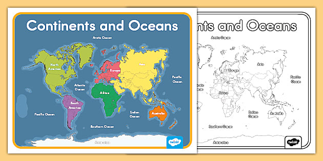
You can use display this poster in your classroom to help your students remember the names and locations of each of the continents and oceans, include it as part of an eye-catching classroom display, use it as a visual teaching tool, or print it in black and white instead of color and use it as a fun coloring activity. 

For more resources, visit https://www.twinkl.com/

Resources

Files

beta
EdBrAIn uses AI to customize lesson resources for your students’ needs.

Black And White Continents And Oceans Map.pdf

Presentation
July 14, 2023
306.46 KB
beta
EdBrAIn uses AI to customize lesson resources for your students’ needs.

Continents And Oceans Map.pdf

Presentation
July 14, 2023
408.97 KB

Reviews

Write A Review

Be the first to submit a review!

Advertisement