Continents and Oceans Map
lesson
88 Downloads
Write a review
beta
EdBrAIn It
EdBrAIn uses AI to customize lesson resources for your students’ needs.

Continents and Oceans Map

Share

Share On Facebook
Share On Twitter
Share On Pinterest
Share On LinkedIn
Email

About This Lesson

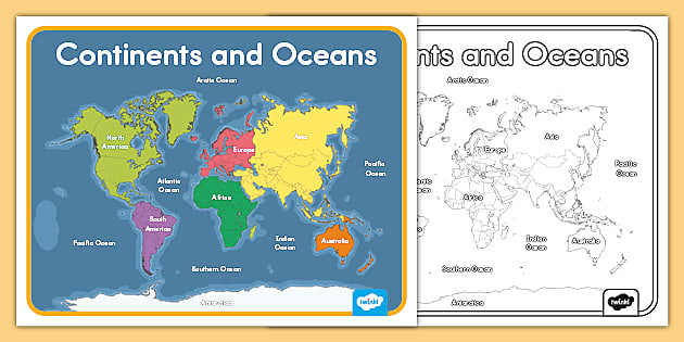
If World Ocean Day is approaching and you want to start teaching your students more about the oceans of the world, you should take a look at our Map of the Oceans and Continents Printable poster. 

You can display this poster in your classroom to help your students remember the names and locations of each of the continents and oceans, include it as part of an eye-catching classroom display, use it as a visual teaching tool, or print it in black and white instead of color and use it as a fun coloring activity. 

For more resources, check out https://www.twinkl.com!

Resources

Files

beta
EdBrAIn uses AI to customize lesson resources for your students’ needs.

Continents And Oceans Map.pdf

Handout, Worksheet
September 29, 2023
2.31 MB
beta
EdBrAIn uses AI to customize lesson resources for your students’ needs.

Black And White Continents And Oceans Map.pdf

Handout, Worksheet
September 29, 2023
2.21 MB

Reviews

Write A Review

Be the first to submit a review!

Advertisement